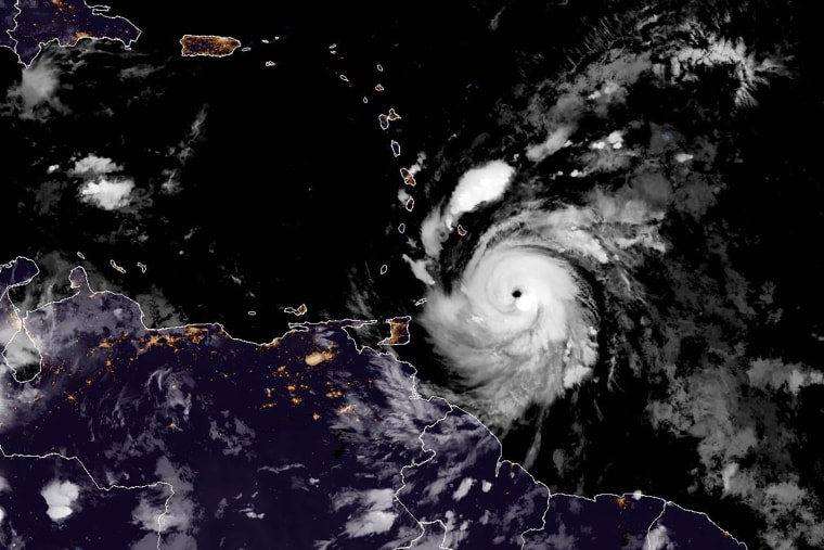
Hours after making landfall on Grenada’s Carriacou Island, Hurricane Beryl strengthened to a “potentially catastrophic” Category 5 storm late Monday as it moved west in the Caribbean on a path forecast to take it near Jamaica, officials said.
Beryl had maximum sustained winds of about 160 mph at 11 p.m., the National Hurricane Center said. The increase in maximum sustained winds from 155 mph to 160 mph late Monday put the storm in Category 5 status, which is 157 mph or above.
In an update at 2 a.m. ET, the NHC said the storm was “still intensifying.”
Some changes in strength are likely, but it is still expected to be at “major hurricane” status by the time it passes Jamaica on Wednesday, the hurricane center said. A “major hurricane” is Category 3 or higher.
“I am encouraging all Jamaicans to take the hurricane as a serious threat,” Jamaica Prime Minister Andrew Holness warned.
Jamaica upgraded its advisory to a hurricane warning, up from a watch, and Holness urged people to seek higher, safer ground. He also warned that emergency services would not be able to operate during the peak of hurricane conditions.
A hurricane watch was issued Tuesday morning for the Cayman’s Islands.
The hurricane was a Category 4 storm with 150 mph winds when its eye made landfall on Carriacou, part of Grenada and the Windward Islands, at 11:10 a.m. Monday, the hurricane center said.
One person was reported to have died in St. Vincent and the Grenadines, Prime Minister Ralph Gonsalves said. He said more details were not known.

“There may well be more fatalities. We are not yet sure,” he said. He added that hundreds of homes on St. Vincent were severely damaged or destroyed.Officials in Grenada said there is believed to be widespread damage, although there have been problems with communication in the wake of the damaging storm.
The southern coasts of the Dominican Republic and Haiti were under tropical storm warnings Monday night.
Beryl is the first Category 4 hurricane on record to form in June. It is also the earliest Category 4 storm of the Atlantic hurricane season, beating the record of Hurricane Dennis, which formed on July 8, 2005.
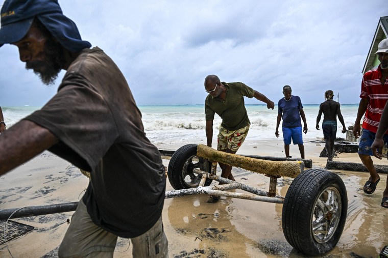
Videos shared by UNICEF Eastern Caribbean show storm surge on the southern coast of Barbados and strong winds in St. Lucia. The U.S. Embassy in Barbados reported power outages and flooding in some areas. The government reported that around 10 inches of rain fell on Carriacou and that landslides remained a threat late Monday.Beryl had been gaining strength last week, intensifying from a tropical depression to a Category 3 hurricane in 42 hours. It became a Category 4 hurricane in 48 hours. According to ClimateCentral.org, hurricanes get stronger at a faster rate because of warm waters brought on by climate change.
Beryl will continue moving westward, across the southeastern and central Caribbean Sea, at least until Wednesday, the agency added.
Jamaica faces the greatest threat from hurricane conditions, National Hurricane Center Director Michael Brennan said, although there could be hurricane-force winds on the Yucatán Peninsula later in the week.
“One small piece of good news is that the atmospheric environment is expected to become less favorable for Beryl to maintain this very high intensity as we go through the week, but the system is expected to remain a major hurricane through Tuesday night or Wednesday morning,” Brennan said in an update around 5 p.m. Monday.
He said the storm is likely to maintain hurricane strength until it gets to the Yucatán Peninsula on Thursday night or early Friday.

The storm was around 840 miles east-southeast of Kingston, Jamaica, at around 11 p.m., the National Hurricane Center said. It was moving west-northwest at 22 mph.Winds of tropical storm strength are forecast to start being felt in Jamaica early Wednesday, which could make unfinished outside preparations dangerous, the National Hurricane Center said.
Storm surges could raise water levels by 3 to 5 feet, it said, and rainfall generally of 4 to 8 inches — and up to 12 inches — could cause flash flooding.
Beryl became an “extremely dangerous” Category 4 storm as it approached the Windward Islands early Sunday before it leveled off slightly.
In Barbados, where officials began ordering all businesses closed by 7 p.m. Sunday, Vichelle Clark King in the capital, Bridgetown, surveyed her damaged shop, which was filled with sand and water after the storm passed Monday.
“Right now, I’m real heartbroken,” she told The Associated Press.
The hurricane is likely to be in the Caribbean Sea for the rest of the week before it makes landfall on the Yucatán Peninsula as a Category 2 storm. It is expected to weaken to a tropical storm as it moves into the southwestern Gulf of Mexico.


